With all initial pre-launch testing looking perfectly normal, PS-56 was released at 7am on Sat 28 Nov 2015.
Shortly after launch it was obvious that something was wrong, there was no WSPR or JT9 data. The payload was continuously resetting itself every 8-10 minutes, sending the default Morse sequence of “VK3YT QF20bc 0000 XXXX” where XXXX is the battery voltage. It appeared that the GPS could not acquire lock at all.
Not giving up easily, the hardcore trackers from VK and ZL were getting prepared for the challenge of tracking a party balloon without GPS.
The payload provided a range of data directly and indirectly:
– Battery voltage
– Sunset
– Sunrise
– Bearing from receiving station.
– Relative signal strength from receiving stations.
Using the sun greyline at sunset and sunrise, antenna bearing and wind prediction, the position of the balloon could be estimated.
This is all the info sent from PS-56 when in sunlight, every 8-10 minutes:

And this was what it sounded like:
PS-56 was tracked like this continuously for a week by Bob ZL1RS, before it got to South America. As expected, the balloon got out of range, and we thought it was the end of it. This was around 2nd December 2015.
On 13th December, Bob reported a possible sighting of PS-56 on the waterfall:
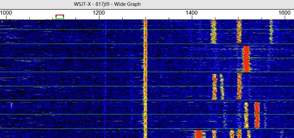
It is the tiny spec of signal directly under the 1000 marker, above the second horizontal line from the bottom.
Bob further narrowed the position down to an area between South America and South Africa using his array of Beverage antennas:
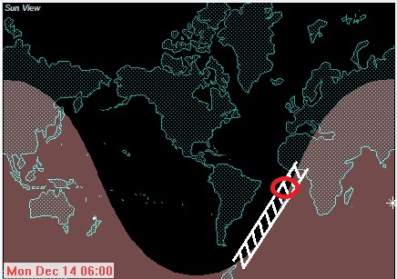
Many ham operators devoted their time and equipment to search for PS-56, with a number of unconfirmed reports.
Fast forward to Sat 19th December, when John VK2FAK and Joe VK5EI spotted PS-56 with strong signal strength at around 11:00 UTC The sunset time was around 11:44 UTC when the last transmission was heard:
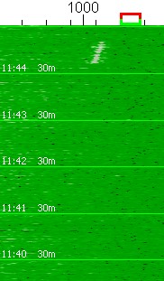
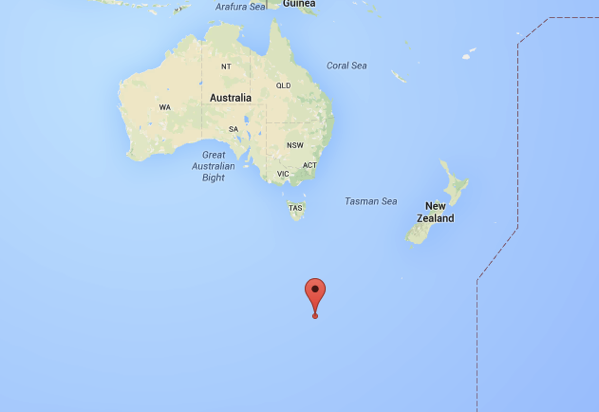
On Sunday morning Bob ZL1RS was receiving the first wake up packets from PS-56 around 17:40UTC. The positions of the Beverage antenna, the sunset and sunrise time estimates the position of PS-56 to be around 55 degree South, and 150 degree East at the time.
This provides confirmation with a large degree of certainty that PS-56 has completed its first circumnavigation of the Southern Hemisphere, and still flying, all while being tracked without a working GPS!
A huge thank-you to everyone for assistance with tracking of PS-56. Even if no signal was received, your participation helped to keep the spirit up through the trip.
Special thanks to Bob, John and Adrian for not giving up!
Update #1 20 Dec 2015
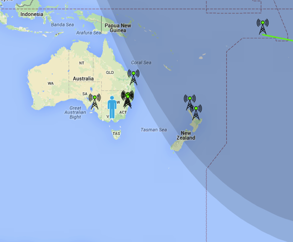
Sun greyline at sunset around 08:10 UTC 20 Dec 2015:
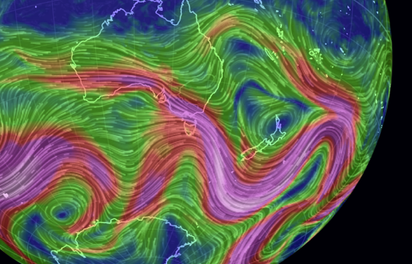
And wind pattern around the area:
Update #2 24 Dec 2015
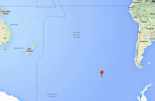
PS-56 is still going East, and the signal is getting weaker with the distance. Estimated position at 1600 AEST 24 Dec 2015 is around (-60,-110) (Grey line at sunset)
Update #3 28 Dec 2015 AEST
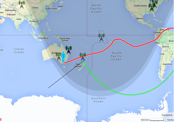
PS-56 is heard from again today, loud and clear from VK and ZL. From the antenna bearing and sunset grey line, it is estimated to be somewhere in the Great Australian Bight, South of VK5.
Sunset grey line at 10:30 UTC. The bearing is between 200 – 240 degrees from ZL1RS, which is at the Northern part of New Zealand.
Update #4 29 Dec 2015 AEST
PS-56 woke up at around 17:48 28 Dec 2015 UTC, putting the likely sunrise time at its position to be around 16:48 UTC.
This is the sunrise greyline at 18:20 UTC
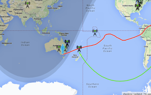
The estimated night time at PS-56’s position is around 6 hours, which projects the latitude to be about -57 degrees.
PS-56 (-57,163):: Sunrise at 16:15:25 2015-12-28, Sunset at 10:06:08 2015-12-28
Bearing from ZL1RS this morning is around 195 degrees, which places PS-56 at around 163E longitude.
PS-56 (-57,163) is 2555km/195.1° from ZL1RS (-35.209,173.811)
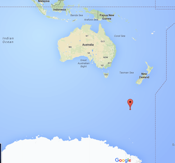
The windspeed across the predicted path is up to 300km/h
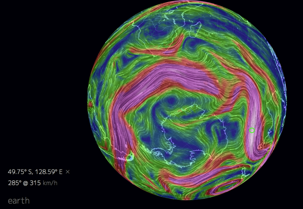
Update #4 7:30pm 29 Dec 2015 AEST
Sunset greyline at balloon location:
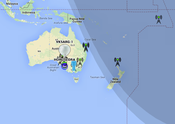
Based on the estimated bearings from RX stations and the last few sunset/sunrise grey lines at balloon location, it is most likely that PS-56 has completed the second circumnavigation, and is on its way up North across the Tasman sea.
Thanks to everyone again for the great tracking effort, especially John VK2FAK and Joe VK5EI for the early detection of the balloon on the way home and Bob ZL1RS for building up accurate estimations of the flight path using only CW data from the balloon.
Update #5 7:30pm 30 Dec 2015 AEST
Sunset grey line at balloon location:
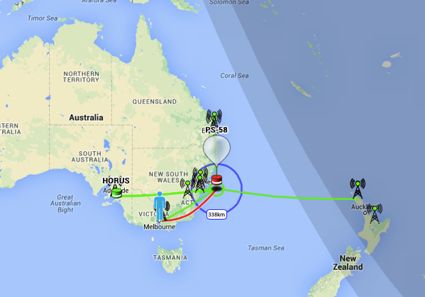
Estimated balloon location is at 37 degrees South, 168 Degree South:
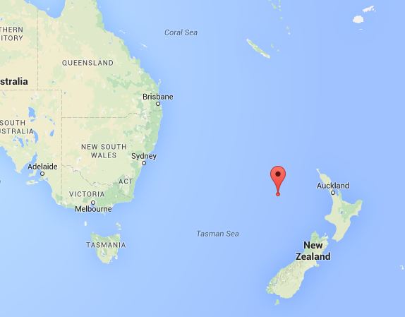
Update #6 10:00am 2 Jan 2016 AEST
PS-56 at sunset yesterday, 0512 1 Jan 2016 UTC
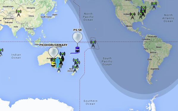
From the bearings it is roughly East of New Zealand, i.e. half way between Australia and South America.
